Lucky Downloads          


Strict

Search results for 'integrate dap'.
338 products found. Showing 156-166 in 10 groups sorted by relevance.


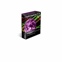
156. Earth Explorer
Earth ExplorerEarth Explorer integrates high-resolution satellite imagery (1km resolution) with kinds of map layers such as political boundaries, coastlines, rivers, lake and island boundaries, 267 countries and regions, 40000+ ranked cities, 15000+ islands, and 1700+ noteworthy historical earthquakes since 1980 into a fantastic 3D earth globe. You can specify what kinds of map layers to be shown, rotate the globe, click right mouse button and pull/push to zoom in/out the current map view, measure distance between any two points on the map, etc. Key features: 1. A 3D bird's-eye view of our beautiful earth; 2. Photo-realistic satellite imagery at 1km resolution covered entire earth globe; 3. Integrates with several kinds of map layers: Vector map layers: 1) Political boundaries (International boundaries and internal boundaries); 2) Coastlines, lakes, islands and rivers; 3) Longitude-latitude grids; Point map layers: 1) 267 countries/regions and detailed information; 2) 40000+ ranked cities and information; 3) 15000+ Islands and information; 4) 1700+ noteworthy historical earthquakes since 1980 and detailed information; 4. Rotate/Zoom in/Zoom out functions lets you observe our beautiful planet at any point (Click right mouse button and pull/push to zoom in/out the current map); 5. Three kinds of operation modes (Drag, Center, Measure); 6. Measure distance between any two points on the globe; 7. Intelligent tips when your mouse moves upon a country/city/island/earthquake's mark or name label; 8. Sort country/city/island/earthquake table according to selected titles and interactive operate with the label and mark on the map; 9. Save favorite maps with BMP, JPEG formats; 10.Realtime online database access and cache mechanism support fast and fluent exploration;
Details   Download trial   Buy now ($29.95)   Find similar
Platform: Windows NT, Windows 2000, Windows XP, Windows 98, Windows ME, Windows Server 2003
Vendor: Motherplanet

157. group@work address standard-version
Group@work address is a COM-Add-In for Microsoft Outlook® 2000 and later that allows you to integrate practically every external data-source (database-systems like Oracle®, SQL-Server®, MySQL®, Access®) into Outlook® as E-Mail address-book.
Details   Download trial   Buy now ($133.60)   Find similar
Platform: Windows NT, Windows 2000, Windows XP, Windows ME, Windows Server 2003
Language: English, German
Vendor: CSD Informations-Technologie GmbH
         158. group@work address professional-version
         Details   Download trial   Buy now ($268.54)   Find similar

159. 2nd Speech Center
Converts any text into spoken words or MP3/WAVE audio files! Additionally, 2nd Speech Center is integrated with many useful and timesaving features, such as talking alarm clock, talking reminder and powerful command lines for advanced users.
Details   Download trial   Buy now ($39.95)   Find similar
Platform: Windows 95, Windows NT, Windows 2000, Windows XP, Windows 98, Windows ME, Windows Server 2003
Vendor: Zero2000 Software

160. Studio Time
Studio Time is a collection of plug-ins for time scale and pitch modifications that easily integrates with software that supports DirectX® plug-ins.
Details   Download trial   Buy now ($119.00)   Find similar
Platform: Windows 2000, Windows XP, Windows 98, Windows ME, Windows Server 2003
Vendor: Acon Digital Media GmbH

161. NVN (for Outlook)
NVN (for Outlook)NVN for Outlook Version 1.23. This is a fully customizable calendar displays itself as your desktop wallpaper by integrating the appointments and tasks from Microsoft® Outlook®.
Details   Download trial   Buy now ($20.86)   Find similar
Platform: Windows 2000, Windows XP, Windows Server 2003
Language: English, German
Vendor: Somebytes

162. Earth Explorer DEM
Earth Explorer DEMEarth Explorer DEM integrates high-resolution shaded relief topographic imagery (built from 1km resolution digital elevation model) with kinds of map layers such as political boundaries, coastlines, rivers, lake and island boundaries, 267 countries and regions, 40000+ ranked cities, 15000+ islands, and 1700+ noteworthy historical earthquakes since 1980 into a fantastic 3D earth globe. You can specify what kinds of map layers to be shown, rotate the globe, click right mouse button and pull/push to zoom in/out the current map view, measure distance between any two points on the map, etc. Key features: 1. A 3D bird's-eye view of our beautiful earth; 2. Photo-realistic shaded relief topographic imagery at 1km resolution covered entire earth globe; 3. Integrates with several kinds of map layers: Vector map layers: 1) Political boundaries (International boundaries and internal boundaries); 2) Coastlines, lakes, islands and rivers; 3) Longitude-latitude grids; Point map layers: 1) 267 countries/regions and detailed information; 2) 40000+ ranked cities and information; 3) 15000+ Islands and information; 4) 1700+ noteworthy historical earthquakes since 1980 and detailed information; 4. Rotate/Zoom in/Zoom out functions lets you observe our beautiful planet at any point (Click right mouse button and pull/push to zoom in/out the current map); 5. Three kinds of operation modes (Drag, Center, Measure); 6. Measure distance between any two points on the globe; 7. Intelligent tips when your mouse moves upon a country/city/island/earthquake's mark or name label; 8. Sort country/city/island/earthquake table according to selected titles and interactive operate with the label and mark on the map; 9. Save favorite maps with BMP, JPEG formats; 10.Realtime online database access and cache mechanism support fast and fluent exploration;
Details   Download trial   Buy now ($39.95)   Find similar
Platform: Windows NT, Windows 2000, Windows XP, Windows 98, Windows ME, Windows Server 2003
Vendor: Motherplanet

163. 1 hour of Custom Software Development
Our products are always designed to grow in order to meet the future needs of your business, and to integrate new technological advancements. Since we are not affiliated with any hardware or software manufacturer, we can design a solution that integrates seamlessly with the existing products and systems you are currently using.
Details   Download trial (Demo: 20 KB)   Buy now ($40.00)   Find similar
Platform: Windows 3.1x, Windows 95, Windows NT, Windows 2000, Windows XP, Windows 98, Windows ME
Vendor: SoftCab Inc

164. InstantGet
InstantGet supports ftp and http protocols, proxy servers, file redirects, cookies, directories with authorization, InstantGet integrates seamlessly into Microsoft Internet Explorer to automatically handle your downloads and can monitor clipboard.
Details   Buy now ($24.95)   Find similar
Vendor: Kylinsoft

165. Earth Explorer DEM Full Version
Earth Explorer DEM Full VersionEarth Explorer DEM integrates high resolution shaded relief topographic imagery and serval kinds of map information together to provide a total 3D view of our beatuiful planet earth. You can rotate the globe, zoom in and out (click mouse right button and pull/push can zoom in/out the view), measure distance between any two points, etc. Key features: 1. Have a 3D bird's-eye view of our beautiful earth; 2. Photo-realistic shaded relief topographic imagery at 1km resolution covered entire earth globe; 3. Integrates with serval kinds of map layers: Vector map layers: 1) Political boundaries (International boundaries and internal boundaries); 2) Coastlines, lakes, islands and rivers; 3) Longitude-latitude grids; Point map layers: 1) Countries/regions distribution and detailed infromation; 2) 40000+ ranked cities distribution and information; 3) Islands distribution and information; 4) Earthquake distribution maps and detailed information (Including 1700+ noteworthy historical earthquakes since 1980); 4. Rotate/Zoom in/Zoom out funtions lets you observe our beautiful planet at any point (Click mouse right button and pull/push to zoom in/out the view); 5. Three kinds of operation modes (Drag, Center, Measure); 6. Measure distance between any two points from the globe; 7. Intelligent tips when your mouse moves upon a country/city/island/earthquake's mark and name label; 8. Sort country/city/island/earthquake table according to selected keywords and interactive operate with the map labels and marks; 9. Save faviorite maps with BMP, JPEG formats;
Details   Download trial   Buy now ($69.95)   Find similar
Platform: Windows NT, Windows 2000, Windows XP, Windows 98, Windows ME, Windows Server 2003
Vendor: Motherplanet

166. CuteFTP Professional (Download-Version)
CuteFTP Professional (Download-Version)Advanced File Transfer for the Security-Minded Professional! CuteFTP Pro® integrates state-of-the-art security standards including SSL via FTP and HTTP, SSH2 and advanced S/KEY password encryption to ensure that confidential business data stays that way.
Details   Buy now ($94.39)   Find similar
Platform: Windows 95, Windows NT, Windows 2000, Windows XP, Windows 98, Windows ME
Language: English, German, Portuguese, Spanish, Italian, French, Norwegian, Dutch, Swedish, Finnish, Multilingual
Vendor: blitzbox.de / Dr. Pott Wirtschaftsberatung GmbH

First page Next page


Strict

Natural Linguistics
Network & desktop search | Search My Network | LAN Find | Reminder software | Software downloads | WordNet-Online dictionary | Thesaurus | CV
Access us via www.LuckyDownloads.com or www.L-DL.com
Copyright © 2005 Lucky Downloads