Lucky Downloads          


Strict

Search results for 'kind line'.
757 products found. Showing 219-228 sorted by relevance.


219. Mybase Desktop Edition (Personal License)
Mybase Desktop Edition (Personal License)Mybase is a unique freeform database software that can store any kind of information you want to organize, such as rich text, web pages, image files, and even binary files. This structure is so flexible that you can easily store almost any kind of your information in a single database.
Details   Download trial   Buy now ($39.00)   Find similar
Platform: Windows 95, Windows NT, Windows 2000, Windows XP, Windows 98, Windows ME
Vendor: WJJ SOFTWARE

220. Crystal Balls
Crystal BallsCrystal Balls is a new life of old idea. Three balls of one color in a line or triangle are eliminated, releasing a place and awarding you points.
Details   Download trial   Buy now ($14.95)   Find similar
Platform: Windows 95, Windows 2000, Windows 98, Windows ME
Vendor: Arty Games

221. Formula calculator
In contrast to majority of calculators it designed as single line on your desktop and 1) occupies minimum of desktop place; 2) lets you type in sequences of operations with many brackets and then calculate the final result (example: 123*(456-78)*sin(1)-exp(0.3)**(1/3)+7).
Details   Download trial (Demo: 856 KB)   Buy now ($15.00)   Find similar
Platform: Windows 95, Windows NT, Windows 2000, Windows 98, Windows ME
Vendor: MVsoft Co

222. 1ST_Tools
NEW (January 2004) version 2.0 - More than 60 scripts and extensions that EVERY ArcView user must have. In a single extension, 1st_Tools provide basic tools for working point, line, and polygon themes.
Details   Download trial (Demo: 300 KB)   Buy now ($40.00)   Find similar
Platform: Windows 95, Windows NT, Windows 2000, Windows XP, Windows 98, Windows ME
Language: Avenue
Vendor: Trdin Andrej

223. Earth Explorer DEM
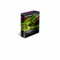
Earth Explorer DEMEarth Explorer DEM integrates high-resolution shaded relief topographic imagery (built from 1km resolution digital elevation model) with kinds of map layers such as political boundaries, coastlines, rivers, lake and island boundaries, 267 countries and regions, 40000+ ranked cities, 15000+ islands, and 1700+ noteworthy historical earthquakes since 1980 into a fantastic 3D earth globe. You can specify what kinds of map layers to be shown, rotate the globe, click right mouse button and pull/push to zoom in/out the current map view, measure distance between any two points on the map, etc. Key features: 1. A 3D bird's-eye view of our beautiful earth; 2. Photo-realistic shaded relief topographic imagery at 1km resolution covered entire earth globe; 3. Integrates with several kinds of map layers: Vector map layers: 1) Political boundaries (International boundaries and internal boundaries); 2) Coastlines, lakes, islands and rivers; 3) Longitude-latitude grids; Point map layers: 1) 267 countries/regions and detailed information; 2) 40000+ ranked cities and information; 3) 15000+ Islands and information; 4) 1700+ noteworthy historical earthquakes since 1980 and detailed information; 4. Rotate/Zoom in/Zoom out functions lets you observe our beautiful planet at any point (Click right mouse button and pull/push to zoom in/out the current map); 5. Three kinds of operation modes (Drag, Center, Measure); 6. Measure distance between any two points on the globe; 7. Intelligent tips when your mouse moves upon a country/city/island/earthquake's mark or name label; 8. Sort country/city/island/earthquake table according to selected titles and interactive operate with the label and mark on the map; 9. Save favorite maps with BMP, JPEG formats; 10.Realtime online database access and cache mechanism support fast and fluent exploration;
Details   Download trial   Buy now ($39.95)   Find similar
Platform: Windows NT, Windows 2000, Windows XP, Windows 98, Windows ME, Windows Server 2003
Vendor: Motherplanet

224. 1,001 Essential Turkish Idioms (for English speakers), book (only)
1,001 Essential Turkish Idioms (for English speakers), book (only)1,001 Essential Turkish Idioms is the first and only book of its kind for English-speaking Turkish-language learners -- and represents the crème de la crème of our multimedia Turkish-idioms encyclopedia on CD (and online).
Details   Buy now ($11.95)   Find similar
Platform: Book supplement for LPT CD
Vendor: four country computing

225. ScreenShot Assistant
ScreenShot Assistant is designed to help you create screenshots. An intergrated image editor allows you to draw lines, rectangles, highlight (color blend) segments of the image, paste other images, and more.
Details   Download trial (Demo: 700 KB)   Buy now ($20.00)   Find similar
Platform: Windows 95, Windows 2000, Windows XP, Windows 98, Windows ME
Vendor: ByteWay

226. Actionball 2003
Actionball 2003Balls who are falling down must be catched with buckets. Actionball 2003 is a new kind of Strategy-Game. There are different kinds of Control-Helpers like conveyors or slips.
Details   Download trial   Buy now ($12.90)   Find similar
Platform: Windows 3.1x, Windows 95, Windows NT, Windows 2000, Windows XP, Windows 98, Windows ME
Language: English, German
Vendor: Happy Future Software

227. Calc 3D
Calc 3DCalc 3D is an international shareware program for calculating 3-dimensional vectors, matrices, complex numbers and quaternions with Windows 95/98/NT. For objects like point, line, plane and sphere distances, intersections, volume, area of squeres, area of a triangle can be calculated.
Details   Download trial   Buy now ($9.90)   Find similar
Language: English, German, Portuguese, Spanish, Italian, portugese
Vendor: Andreas Greuer

228. Earth Explorer DEM Full Version
Earth Explorer DEM Full VersionEarth Explorer DEM integrates high resolution shaded relief topographic imagery and serval kinds of map information together to provide a total 3D view of our beatuiful planet earth. You can rotate the globe, zoom in and out (click mouse right button and pull/push can zoom in/out the view), measure distance between any two points, etc. Key features: 1. Have a 3D bird's-eye view of our beautiful earth; 2. Photo-realistic shaded relief topographic imagery at 1km resolution covered entire earth globe; 3. Integrates with serval kinds of map layers: Vector map layers: 1) Political boundaries (International boundaries and internal boundaries); 2) Coastlines, lakes, islands and rivers; 3) Longitude-latitude grids; Point map layers: 1) Countries/regions distribution and detailed infromation; 2) 40000+ ranked cities distribution and information; 3) Islands distribution and information; 4) Earthquake distribution maps and detailed information (Including 1700+ noteworthy historical earthquakes since 1980); 4. Rotate/Zoom in/Zoom out funtions lets you observe our beautiful planet at any point (Click mouse right button and pull/push to zoom in/out the view); 5. Three kinds of operation modes (Drag, Center, Measure); 6. Measure distance between any two points from the globe; 7. Intelligent tips when your mouse moves upon a country/city/island/earthquake's mark and name label; 8. Sort country/city/island/earthquake table according to selected keywords and interactive operate with the map labels and marks; 9. Save faviorite maps with BMP, JPEG formats;
Details   Download trial   Buy now ($69.95)   Find similar
Platform: Windows NT, Windows 2000, Windows XP, Windows 98, Windows ME, Windows Server 2003
Vendor: Motherplanet

First page Next page


Strict

Natural Linguistics
Network & desktop search | Search My Network | LAN Find | Reminder software | Software downloads | WordNet-Online dictionary | Thesaurus | CV
Access us via www.LuckyDownloads.com or www.L-DL.com
Copyright © 2005 Lucky Downloads