Lucky Downloads          


Strict

Search results for 'zoom lens'.
125 products found. Showing 35-47 in 10 groups sorted by relevance.


35. 2D Graphics
2D Graphics is a program for drawing and manipulating geometric figures under DOS. You can draw, move, resize, rotate, zoom and stretch lines, ellipses, circles, rectangles and any kind of polygons.
Details   Buy now ($48.67)   Find similar
Platform: Windows 95, MS DOS, Windows XP, Windows 98, Windows ME, Windows Server 2003
Vendor: George Yaneff

36. Graph Wizard
Graph WizardThis Word AddIn component expands Word application so that you can draw graphs directly into your document. Zooming.
Details   Download trial   Buy now ($20.86)   Find similar
Platform: Windows NT, Windows 2000, Windows XP, Windows 98, Windows ME, Windows Server 2003
Language: English, Russian
Vendor: Loser Enterprise

37. Cleanerzoomer
Cleanerzoomer is the one tool combining image cleaning and zooming abilities in one low-cost solution.
Details   Download trial   Buy now ($35.00)   Find similar
Platform: Windows 95, Windows NT, Windows 2000, Windows XP, Windows 98, Windows ME
Vendor: Stratopoint Software

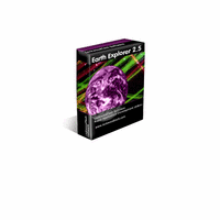
38. Earth Explorer
Earth ExplorerYou can specify what kinds of map layers to be shown, rotate the globe, click right mouse button and pull/push to zoom in/out the current map view, measure distance between any two points on the map, etc. Key features: 1. A 3D bird's-eye view of our beautiful earth; 2. Photo-realistic satellite imagery at 1km resolution covered entire earth globe; 3. Integrates with several kinds of map layers: Vector map layers: 1) Political boundaries (International boundaries and internal boundaries); 2) Coastlines, lakes, islands and rivers; 3) Longitude-latitude grids; Point map layers: 1) 267 countries/regions and detailed information; 2) 40000+ ranked cities and information; 3) 15000+ Islands and information; 4) 1700+ noteworthy historical earthquakes since 1980 and detailed information; 4. Rotate/Zoom in/Zoom out functions lets you observe our beautiful planet at any point (Click right mouse button and pull/push to zoom in/out the current map); 5. Three kinds of operation modes (Drag, Center, Measure); 6. Measure distance between any two points on the globe; 7. Intelligent tips when your mouse moves upon a country/city/island/earthquake's mark or name label; 8. Sort country/city/island/earthquake table according to selected titles and interactive operate with the label and mark on the map; 9. Save favorite maps with BMP, JPEG formats; 10.Realtime online database access and cache mechanism support fast and fluent exploration;
Details   Download trial   Buy now ($29.95)   Find similar
Platform: Windows NT, Windows 2000, Windows XP, Windows 98, Windows ME, Windows Server 2003
Vendor: Motherplanet

39. FirmTools PanoramaComposer
FirmTools Panorama Composer will help you to construct pans from series of your photos, save them as panoramic photo (jpg image), as the web page (html with ActiveX viewer) and as the postcard (standalone viewer - EXE file) so you can send them to your friends and they can view them without any special programs installed. 3. Creation of full 360 degrees flat pans; 4. Saving result pans in jpg, html and exe formats; 5. Saving pans as projects that can be modified later; 6. Automatic lens type detection.
Details   Download trial   Buy now ($29.95)   Find similar
Platform: Windows 95, Windows NT, Windows 2000, Windows XP, Windows 98, Windows ME, Windows Server 2003
Vendor: FirmTools

40. Earth Explorer DEM
Earth Explorer DEMYou can specify what kinds of map layers to be shown, rotate the globe, click right mouse button and pull/push to zoom in/out the current map view, measure distance between any two points on the map, etc. Key features: 1. A 3D bird's-eye view of our beautiful earth; 2. Photo-realistic shaded relief topographic imagery at 1km resolution covered entire earth globe; 3. Integrates with several kinds of map layers: Vector map layers: 1) Political boundaries (International boundaries and internal boundaries); 2) Coastlines, lakes, islands and rivers; 3) Longitude-latitude grids; Point map layers: 1) 267 countries/regions and detailed information; 2) 40000+ ranked cities and information; 3) 15000+ Islands and information; 4) 1700+ noteworthy historical earthquakes since 1980 and detailed information; 4. Rotate/Zoom in/Zoom out functions lets you observe our beautiful planet at any point (Click right mouse button and pull/push to zoom in/out the current map); 5. Three kinds of operation modes (Drag, Center, Measure); 6. Measure distance between any two points on the globe; 7. Intelligent tips when your mouse moves upon a country/city/island/earthquake's mark or name label; 8. Sort country/city/island/earthquake table according to selected titles and interactive operate with the label and mark on the map; 9. Save favorite maps with BMP, JPEG formats; 10.Realtime online database access and cache mechanism support fast and fluent exploration;
Details   Download trial   Buy now ($39.95)   Find similar
Platform: Windows NT, Windows 2000, Windows XP, Windows 98, Windows ME, Windows Server 2003
Vendor: Motherplanet

41. JProfiler
JProfilerJProfiler is a fully dynamic profiler based on the Java virtual machine profiling interface (JVMPI). Find out where your CPU time is going and zoom into the time-resolved status of your threads.
Details   Download trial   Buy now ($499.00)   Find similar
Platform: Windows 95, Unix / Linux, Mac OS 9/Classic, Windows NT, Windows 2000, Windows XP, Windows 98, Windows ME, Mac OS X
Vendor: ej-technologies GmbH
         42. JProfiler with Gold Support
         Details   Download trial   Buy now ($698.00)   Find similar

43. Earth Explorer Full Version
Earth Explorer Full VersionEarth Explorer integrates high resolution satellite imagery (1km resolution) with kinds of map layers such as political boundaries, coastlines, rivers, lake and island boundaries, 267 countries and regions, 40000+ ranked cities, 15000+ islands, and 1700+ noteworthy historical earthquakes since 1980 into a fantastic 3D earth globe. You can specify what kinds of map layers to be shown, rotate the globe, click right mouse button and pull/push to zoom in/out the current map view, measure distance between any two points on the map, etc.
Details   Download trial   Buy now ($49.95)   Find similar
Platform: Windows NT, Windows 2000, Windows XP, Windows 98, Windows ME, Windows Server 2003
Vendor: Motherplanet

44. TransitionFX
TransitionFX ActiveX Control produces more than 170 image transition effects. Zoom. ZoomIn. ZoomOut.
Details   Download trial (Demo: 884 KB)   Buy now ($49.95)   Find similar
Platform: Windows 95, Windows NT, Windows 2000, Windows XP, Windows 98, Windows ME
Vendor: Chirag Dalal
         45. TTransitionFX
         Details   Download trial (Demo: 933 KB)   Buy now ($74.95)   Find similar
         46. AnimationFX
         Details   Download trial (Demo: 847 KB)   Buy now ($49.95)   Find similar

47. TAnimationFX
TAnimationFX component produces more than 150 animation effects on images. Zoom. ZoomIn. ZoomOut.
Details   Download trial (Demo: 1.1 MB)   Buy now ($74.95)   Find similar
Platform: Windows 95, Windows NT, Windows 2000, Windows XP, Windows 98, Windows ME
Vendor: Chirag Dalal

First page Next page


Strict

Natural Linguistics
Network & desktop search | Search My Network | LAN Find | Reminder software | Software downloads | WordNet-Online dictionary | Thesaurus | CV
Access us via www.LuckyDownloads.com or www.L-DL.com
Copyright © 2005 Lucky Downloads