![]()
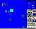 | Contains over 60 missions & campaigns and 40 ship, submarine, airplane & port artillery types, with combat maps up to 96X96 large. Game objectives: conquer all enemy major ports, defend your ports, destroy enemy ships, secure transport convoy to the friendly port. |
 | You can use it also with USB devices, because these devices usually have a driver that redirects the input from the USB port to a virtual serial port. This component works with any NMEA compatible receiver connected to one of the serial ports. |
 | Earth Explorer integrates high-resolution satellite imagery (1km resolution) with kinds of map layers such as political boundaries, coastlines, rivers, lake and island boundaries, 267 countries and regions, 40000+ ranked cities, 15000+ islands, and 1700+ noteworthy historical earthquakes since 1980 into a fantastic 3D earth globe. You can specify what kinds of map layers to be shown, rotate the globe, click right mouse button and pull/push to zoom in/out the current map view, measure distance between any two points on the map, etc. Key features: 1. A 3D bird's-eye view of our beautiful earth; 2. Photo-realistic satellite imagery at 1km resolution covered entire earth globe; 3. Integrates with several kinds of map layers: Vector map layers: 1) Political boundaries (International boundaries and internal boundaries); 2) Coastlines, lakes, islands and rivers; 3) Longitude-latitude grids; Point map layers: 1) 267 countries/regions and detailed information; 2) 40000+ ranked cities and information; 3) 15000+ Islands and information; 4) 1700+ noteworthy historical earthquakes since 1980 and detailed information; 4. Rotate/Zoom in/Zoom out functions lets you observe our beautiful planet at any point (Click right mouse button and pull/push to zoom in/out the current map); 5. Three kinds of operation modes (Drag, Center, Measure); 6. Measure distance between any two points on the globe; 7. Intelligent tips when your mouse moves upon a country/city/island/earthquake's mark or name label; 8. Sort country/city/island/earthquake table according to selected titles and interactive operate with the label and mark on the map; 9. Save favorite maps with BMP, JPEG formats; 10.Realtime online database access and cache mechanism support fast and fluent exploration; |
 | Earth Explorer DEM integrates high-resolution shaded relief topographic imagery (built from 1km resolution digital elevation model) with kinds of map layers such as political boundaries, coastlines, rivers, lake and island boundaries, 267 countries and regions, 40000+ ranked cities, 15000+ islands, and 1700+ noteworthy historical earthquakes since 1980 into a fantastic 3D earth globe. You can specify what kinds of map layers to be shown, rotate the globe, click right mouse button and pull/push to zoom in/out the current map view, measure distance between any two points on the map, etc. Key features: 1. A 3D bird's-eye view of our beautiful earth; 2. Photo-realistic shaded relief topographic imagery at 1km resolution covered entire earth globe; 3. Integrates with several kinds of map layers: Vector map layers: 1) Political boundaries (International boundaries and internal boundaries); 2) Coastlines, lakes, islands and rivers; 3) Longitude-latitude grids; Point map layers: 1) 267 countries/regions and detailed information; 2) 40000+ ranked cities and information; 3) 15000+ Islands and information; 4) 1700+ noteworthy historical earthquakes since 1980 and detailed information; 4. Rotate/Zoom in/Zoom out functions lets you observe our beautiful planet at any point (Click right mouse button and pull/push to zoom in/out the current map); 5. Three kinds of operation modes (Drag, Center, Measure); 6. Measure distance between any two points on the globe; 7. Intelligent tips when your mouse moves upon a country/city/island/earthquake's mark or name label; 8. Sort country/city/island/earthquake table according to selected titles and interactive operate with the label and mark on the map; 9. Save favorite maps with BMP, JPEG formats; 10.Realtime online database access and cache mechanism support fast and fluent exploration; |
 | This program allows you to check the flow of data through a computer's COM ports. |
 |  |

Network & desktop search |
Search My Network |
LAN Find |
Reminder software |
Software downloads |
WordNet-Online dictionary |
Thesaurus |
CV
Access us via www.LuckyDownloads.com
or www.L-DL.com
Copyright © 2005 Lucky Downloads