Lucky Downloads          


Strict

Search results for 'sphere distance'.
64 products found. Showing 14-26 in 10 groups sorted by relevance.


14. MilkShape 3D
MilkShape 3D is a low-polygon modeler, which was initially designed for Half-Life. Primitives like spheres, boxes and cylinders are also available.
Details   Download trial   Buy now ($33.74)   Find similar
Platform: Windows 2000, Windows XP, Windows 98
Vendor: chUmbaLum sOft

15. ChanFlow
Features ChanFlow Open Channel Software (www.flowlab.co.nz): - Easy editing of main parameters and cross-sections - Option of time dependant boundary conditions for water level and discharge - Handles subcritical and supercritical flow including dambreak simulation - Capabilitiy of handling riverbed geometries - Saving and loading of calculated results and geometry as input/project file - Calculation and display of depth, water level, velocity, discharge and froude number as functions of distance and time - Option to store calculated results for further processing - Option to incorporate lateral inflow/outflow - Graphic display of boundary conditions as functions of time - Requires Java 2 Runtime Environment (free download) - Includes uninstall option.
Details   Download trial   Buy now ($99.00)   Find similar
Platform: Windows NT, Windows 2000, Windows XP, Windows 98, Windows ME
Vendor: Jan Arts

16. Pigeons Progress for Clubs
This product is intended primarily for use by pigeon clubs and federations and has the following abilities: Members Register. Can calculate distances for each flyer for you Aggregates.
Details   Download trial   Buy now ($144.00)   Find similar
Platform: Windows 95, Windows NT, Windows 2000, Windows XP, Windows 98, Windows ME
Vendor: Panache Solutions

17. Earth Explorer Full Version
Earth Explorer Full VersionEarth Explorer integrates high resolution satellite imagery (1km resolution) with kinds of map layers such as political boundaries, coastlines, rivers, lake and island boundaries, 267 countries and regions, 40000+ ranked cities, 15000+ islands, and 1700+ noteworthy historical earthquakes since 1980 into a fantastic 3D earth globe. You can specify what kinds of map layers to be shown, rotate the globe, click right mouse button and pull/push to zoom in/out the current map view, measure distance between any two points on the map, etc.
Details   Download trial   Buy now ($49.95)   Find similar
Platform: Windows NT, Windows 2000, Windows XP, Windows 98, Windows ME, Windows Server 2003
Vendor: Motherplanet

18. Rt-Science Plot
Rt-Science Plot
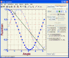
Rt-Plot is a tool to generate Cartesian X/Y-plots from scientific data. All distances colors styles can be varied. All distances in axis, scaling, numberings, captions colors, line- and point styles and colors can be altered.
Details   Download trial   Buy now ($50.00)   Find similar
Platform: Windows 95, Windows NT, Windows 2000, Windows XP, Windows 98, Windows ME
Language: English, German, English or German
Vendor: Rt-Science

19. CompeGPS LAND
CompeGPS LANDCompeGPS Land is a complete software package which connects your GPS to a PC, enabling a flow of information GPS= >PC and PC= >GPS. Measure distances.
Details   Download trial   Buy now ($111.22)   Find similar
Platform: Windows NT, Windows 2000, Windows XP, Windows 98, Windows ME
Language: english, german, spanish, french, italian, japanese,
Vendor: CompeGPS Team, SL
         20. CompeGPS LAND with CD-ROM
         Details   Buy now ($139.02)   Find similar
         21. CompeGPS LAND Alpina
         Details   Download trial   Buy now ($111.22)   Find similar

22. HiCalendar
HiCalendar
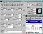
HiCalendar converts dates to Gregorian, Julian, Islamic, Jewish and Chinese dates and back. Moon's age, phases, lunation, angular diameter, distance;
Details   Download trial   Buy now ($15.00)   Find similar
Platform: Windows 95, Windows NT, Windows 2000, Windows XP, Windows 98, Windows ME
Vendor: Mouloud Siaci

23. Desktop Master Lite
Desktop Master V3.0 Lite Desktop Master. So the distance can be overcome when needed. The main purpose of the aforementioned software is to observe, manage and control a remote computer in any physical distance, as if the user is touching the remote machine.
Details   Download trial   Buy now ($9.99)   Find similar
Platform: Windows 95, Windows NT, Windows 2000, Windows XP, Windows 98, Windows ME, Windows Server 2003
Language: English, German
Vendor: Intelligence Technology Systems
         24. Desktop Master Pro
         Details   Download trial   Buy now ($39.99)   Find similar

25. Nozzles Collection For Painter PC MAC MACOSX
Nozzles (for Painter) COMPLETE. The nozzles are in the shapes of blobs, stars, spheres, 3D designs, brush strokes, rings, glowing shapes, warped, lines, multi-colored, jewels,.. and more.
Details   Download trial (Full version: 134.4 MB)   Buy now ($29.99)   Find similar
Platform: Mac OS 9/Classic, Windows NT, Windows 2000, Windows XP, Windows 98, Windows ME, Mac OS X
Vendor: Abneil software Ltd

26. Earth Explorer
Earth ExplorerYou can specify what kinds of map layers to be shown, rotate the globe, click right mouse button and pull/push to zoom in/out the current map view, measure distance between any two points on the map, etc. Key features: 1. A 3D bird's-eye view of our beautiful earth; 2. Photo-realistic satellite imagery at 1km resolution covered entire earth globe; 3. Integrates with several kinds of map layers: Vector map layers: 1) Political boundaries (International boundaries and internal boundaries); 2) Coastlines, lakes, islands and rivers; 3) Longitude-latitude grids; Point map layers: 1) 267 countries/regions and detailed information; 2) 40000+ ranked cities and information; 3) 15000+ Islands and information; 4) 1700+ noteworthy historical earthquakes since 1980 and detailed information; 4. Rotate/Zoom in/Zoom out functions lets you observe our beautiful planet at any point (Click right mouse button and pull/push to zoom in/out the current map); 5. Three kinds of operation modes (Drag, Center, Measure); 6. Measure distance between any two points on the globe; 7. Intelligent tips when your mouse moves upon a country/city/island/earthquake's mark or name label; 8. Sort country/city/island/earthquake table according to selected titles and interactive operate with the label and mark on the map; 9. Save favorite maps with BMP, JPEG formats; 10.Realtime online database access and cache mechanism support fast and fluent exploration;
Details   Download trial   Buy now ($29.95)   Find similar
Platform: Windows NT, Windows 2000, Windows XP, Windows 98, Windows ME, Windows Server 2003
Vendor: Motherplanet

First page Next page


Strict

Natural Linguistics
Network & desktop search | Search My Network | LAN Find | Reminder software | Software downloads | WordNet-Online dictionary | Thesaurus | CV
Access us via www.LuckyDownloads.com or www.L-DL.com
Copyright © 2005 Lucky Downloads